K-12 Resources
Lesson Plans
Acid Rain
This lab explores the creation of acid rain using carbonic, nitrous, nitric, and sulfurous acids.
Capillary Action and Adhesion
Water can move through the ground not only by the direct influence of gravity and the indirect influence of gravity on overlying water but by the physical property known as adhesion. Adhesion is why water exists immediately above the water table, and how water travels up a tree.
Is Dilution the Solution to Pollution?
This lab demonstrates the meaning of dilution and shows the possible disconnect between appearance and actual water quality.
Drinking Dirty Water
This lesson teaches the importance of clean drinking water and shows that water quality can not be determined solely by appearance.
Is Your Water Clean?
Over 2 million people rely on groundwater from karst aquifers in central Texas. Due to the high porosity and permeability of karst landscapes, inputs such as rain, streams, and rivers influence groundwater quality. In this lab students will compare the quality of water from different sources. This lesson involves students testing samples of water from different sources for pollutants and discussing the possible sources of these pollutants.
Strength of Water
While this exercise is applicable to multiple topics, as written here, it addresses the power of groundwater to prevent subsidence. Subsidence of the ground surface occurs water filling pore spaces is removed. Water is not compressible, so the overlying sediment and rock is supported. Removal of the water leaves only air space, which is easily compressed by the overburden. This exercise demonstrates how both water and gas react when pressure is applied.
Water Cycle
This lesson demonstrates the basic principles of the water cycle, especially evaporation and condensation.
Water Filtration Competition
Millions of people in the US rely solely on groundwater for their drinking water, and nearly everyone relies on groundwater to irrigate farmland. Water is filtered as it flows through the ground, but the type of material through which it flows and the length of flow varies considerably. Even municipal water systems have limited ability to filter water, particularly when the type of contaminant is unknown. This lesson/competition allows the students to design a water filtration system. Students should learn the complexity of purifying water, and therefore the importance of preventing pollution in the first place.
Water Pressure
Artesian wells and springs flow up from the ground with varying amounts of force. This force is from the pressure of water elsewhere in the aquifer at higher elevations. This demonstration illustrates how the force of water is related to the amount of overlying water.
Aquifer Maps

Carrizo-Wilcox Aquifer: The Wilcox Group and the overlying Carrizo Formation of the Claiborne Group form a hydrologically connected system known as the Carrizo-Wilcox aquifer. This aquifer extends from the Rio Grande in South Texas northeastward into Arkansas and Louisiana, providing water to all or parts of 60 counties.

Cenozoic Pecos Alluvium Aquifer: Located in the upper part of the Pecos River Valley of West Texas, this aquifer provides water to parts of Andrews, Crane, Ector, Loving, Pecos, Reeves, Upton, Ward, and Winkler counties. The aquifer provides water for irrigation, industrial, power generation, and public supply uses elsewhere.

Edwards Aquifer: The Edwards (Balcones Fault Zone, or BFZ) aquifer covers approximately 4,350 square miles in parts of 11 counties. The aquifer forms a narrow belt extending from a ground-water divide in Kinney County through the San Antonio area northeastward to the Leon River in Bell County.

Edwards-Trinity (Plateau) Aquifer: The Edwards-Trinity (Plateau) aquifer underlies the Edwards Plateau east of the Pecos River and the Stockton Plateau west of the Pecos River, providing water to all or parts of 38 counties. The aquifer extends from the Hill Country of Central Texas to the Trans-Pecos region of West Texas.

Gulf Coast Aquifer: The Gulf Coast aquifer forms a wide belt along the Gulf of Mexico from Florida to Mexico. In Texas, the aquifer provides water to all or parts of 54 counties and extends from the Rio Grande northeastward to the Louisiana-Texas border. Municipal and irrigation uses account for 90 percent of the total pumpage from the aquifer.

Hueco-Mesilla Bolson Aquifer: The Hueco and Mesilla Bolson aquifers are located in El Paso and Hudspeth counties in the far western tip of Texas. The aquifers are composed of Tertiary and Quaternary basin-fill (bolson) deposits that extend northward into New Mexico and westward into Mexico.

Ogallala Aquifer: The Ogallala aquifer, the major water-bearing unit in the High Plains of Texas, provides water to all or parts of 46 counties. Water-bearing areas of the Ogallala are laterally connected except where the Canadian River has eroded through the formation, thereby forming the boundary between two separate flow systems referred to as the Northern and Southern High Plains.

Seymour Aquifer: The Seymour Formation consists of isolated areas of alluvium found in parts of 23 north-central and Panhandle counties. Approximately 90 percent of the water pumped from the aquifer is used for irrigation. Municipal pumpage, primarily for the communities of Vernon, Burkburnett, and Electra, accounts for eight percent.

Trinity Aquifer: The Trinity aquifer consists of early Cretaceous age formations of the Trinity Group where they occur in a band extending through the central part of the state in all or parts of 55 counties, from the Red River in North Texas to the Hill Country of South-Central Texas.

Major Aquifers of Texas: Map showing areas with the major aquifers in Texas including Pecos Valley, Seymour, Gulf Coast, Carrizo-Wilcox, Hueco-Mesilla Bolsons, Ogallala, Edwards-Trinity (Plateau), Edwards (Balcones Fault Zone), and Trinity.

Minor Aquifers of Texas: Map showing areas with the minor aquifers in Texas – including the Brazos River Alluvium, West Texas Bolsons, Lipan, Yegua-Jackson, Igenous, Sparta, Queen City, Nacatoch, Blossom, Woodbine, Rita Blanca, Edwards-Trinity (High Plains), Dockum, Rustler, Captain Reef Complex, Blaine, Bone Spring-Victorio Peak, Marble Falls, Marathon, Ellenburger-San Saba, Hickory.
Other Water-Related Maps


Games
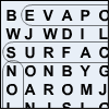
Groundwater Word Search: The Groundwater Word Search is a printable puzzle with groundwater educational content.

Groundwater Crossword Puzzles: If you like crossword puzzles our Groundwater Crossword Puzzles are both educational and entertaining. It helps by testing your knowledge on the subject of groundwater. There are two different versions available.
Groundwater Quizzes: The Groundwater Quizzes help to test your knowledge on the subject of groundwater. You will be able to choose different sections to be tested on. Each section corresponds to the sections throughout the website.
Glossaries
High School Glossary: This glossary was designed for high school level students. The words listed are covered throughout the groundwater site. Extra words have been included that are not covered but pertain to the groundwater topic for further enrichment. This glossary includes elementary and middle school level words plus additional high school level words.
Middle School Glossary: This glossary was designed for middle school level students. The words listed are covered throughout the groundwater site. Extra words have been included that are not covered but pertain to the groundwater topic for further enrichment. This glossary includes elementary-level words plus additional middle school-level words.
Elementary School Glossary: This glossary was designed for elementary-level students. The words listed are covered throughout the groundwater site. Extra words have been included that are not covered but pertain to the groundwater topic for further enrichment.
Videos
Roads on Groundwater
Dr. Barb Mahler of the U.S. Geological Survey and The University of Texas at Austin, discusses the relationship between roads and groundwater.
Groundwater and Atmosphere
Examines the relationships between plant life, groundwater and the atmosphere.
Groundwater and Public Policy
Dr. Kent Butler of The University of Texas School of Architecture, explains the relationship between economic growth and the restrictive water supplies.
Solutions for Development: Rainwater Harvesting
Dr. Kent Butler of The University of Texas School of Architecture, explains the benefits of rainwater harvesting.
Groundwater Contamination
Dr. Barb Mahler of the U.S. Geological Survey and The University of Texas at Austin, explains how everyday contaminants can infiltrate drinking water.