Studying the Earth From Manned Spacecraft?
JANUARY 28, 2000
Dr. William Muehlberger
The University of Texas at Austin
What is the talk about?
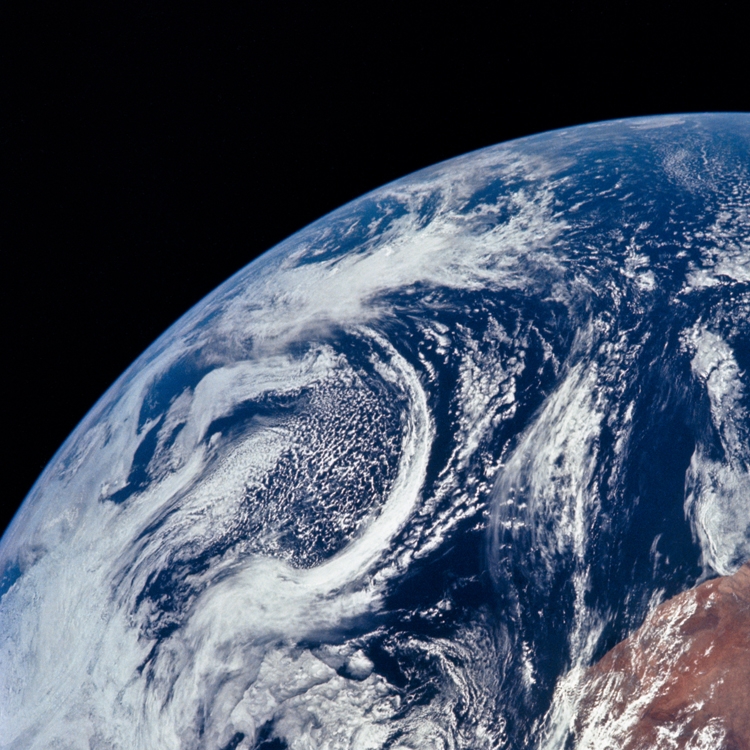
From the early Mercury missions (1961) until now, astronauts have been observing and photographing the Earth. Their ability to photograph in any direction and under different lighting conditions makes their photographs and observations an important and critical supplement to unmanned orbital spacecraft, which can only look straight down and usually are over a feature at a fixed time of day. Since most of these photographs are in color, they are excellent teaching aids. This lecture will show many of Earth’s surface features that were first identified by astronaut observations, as well as a set of pictures taken of plate tectonic boundaries. Insight into many geologic, atmospheric, and oceanic processes will be gleaned from large-scale images of active volcanoes, deltas, mountain ranges, glaciers, ocean gyres, hurricanes, rivers that have altered course, dust storms that cross oceans, and much more. Assessing the impact of human activities on these processes becomes more important in the new century, and can be addressed using these unique views of Earth.
About our presenter
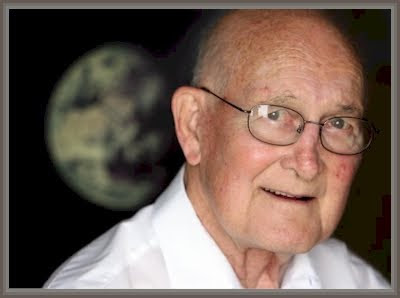
Dr. William Muehlberger
William Muehlberger was a professor of Geology at UT Austin where he studied structural geology and tectonics. Dr. Muehlberger’s interest in geology was inspired by Boy Scout field trips into the San Gabriel Mountains and by a high school course in physical science taught by a Caltech graduate who had received a degree in geology. Dr. Muehlberger went on to obtain a PhD in Structural Geology with a minor in Vertebrate Paleontology at Caltech. He was the principal geology investigator of both the Apollo 16 and 17 missions to the moon, for NASA.